Crime Hotspot Cape Town: Garden Center Off ramp after dark
May 18, 2026
The Mill Street Off-Ramp at Gardens Centre: the Cape Town crime hotspot you should know about
Pay attention at the Gardens off-ramp by the KFC after dark. The Mill Street ramp comes off the M3 and drops to a traffic light directly under a road bridge, next to a skatepark. Numerous robbery attempts have been reported at this corner. Three things make it more exposed than the rest of the area: no City Improvement District covers the corner, the streetlights belong to SANRAL (the national road agency) rather than the City of Cape Town, and central Cape Town police have been flagging traffic-light robberies as their leading concern since early 2025. What follows is each one, in turn, plus practical advice for drivers using the ramp.
The hotspot in two paragraphs
The M3 freeway ends at a single off-ramp at Mill Street, the road that runs along the lower edge of the Gardens neighbourhood. The ramp drops to a traffic light directly under a road bridge, with a public skatepark on the other side. The corner sits in central Cape Town, only about 850 metres from the city’s main police station. On paper, it should be well-covered. In practice, it is not.
Two City Improvement Districts (CIDs), the paid private-security zones described in detail below, end on this block. Neither covers the junction itself. The streetlights on the ramp are managed by SANRAL, the national road agency, rather than the City of Cape Town, which means the City’s repair teams are not allowed to fix them. The result is a small junction with cover from a bridge, a skatepark and a dark road behind, and no dedicated CCTV camera or foot-patrol officer assigned to watch it.
The hotspot on a map
The schematic below shows the corner from above. The interactive map (further down) plots the same features on a real street grid. Use either to orient yourself before reading on.
Open the full map in a new tab → View on Google Street View →
Coordinates verified via Google Places, May 2026. Mill Street Bridge Skatepark at -33.9343, 18.4199. The off-ramp lands at the traffic light about 30 metres east of the skatepark. The KFC and Gardens Shopping Centre (the small mall the off-ramp is named for) are 180 m further west on Mill Street. SAPS Cape Town Central police station is 850 m to the north on Buitenkant Street.
Key terms used in this article, click any pill for the definition
In this article
What makes this junction a hotspot
A crime hotspot is a small location, usually no more than a few hundred metres across, where one type of crime keeps happening more often than the surrounding crime rate would predict. The Mill Street off-ramp meets that definition for traffic-light robberies. Three things put it there, and they stack on top of each other.
1. It is not in any CID. A City Improvement District (CID) is the paid private-security zone described in the box at the top of the article. Across central Cape Town, CIDs are why a tourist walking through the CBD at noon will pass yellow-bibbed safety officers every block. Two CIDs end on Mill Street: the Cape Town Central CID (CCID), which stops at Buitensingel Street to the north, and the proposed Lower Gardens CID, which uses Mill Street as its southern edge. The off-ramp itself, the skatepark and the traffic light all sit south of Mill Street, outside both CIDs. There is no foot patrol assigned to this corner, no CCTV camera in the CID control rooms watching it, and no dedicated private response number to dial.
2. The City cannot fix the streetlights. The streetlights on the off-ramp belong to SANRAL, the national company that manages the M3 freeway and its slip roads. Mill Street itself is a City of Cape Town road, lit by City lamps. But the off-ramp is national infrastructure. When the ramp lights are out, residents who report it through the City’s 0860 103 089 line are told it is not the City’s to fix. SANRAL does not run a 24-hour fault-reporting hotline of the kind the City does. The lights stay out for long stretches.
3. The local police precinct has been flagging this exact pattern for over a year. In March 2025, at the first Community Police Forum (CPF) meeting of the year at Cape Town Central police station, the precinct’s crime-intelligence officer, Captain Armand Brink, told residents that traffic-light robberies were the precinct’s leading active concern. Cellphones being grabbed through open windows. Chains snatched. Aggravated robbery threatened with knives. The senior officer chairing the meeting, Colonel Natasha Thomas, separately flagged a sharp rise in carjacking, particularly of e-hailing drivers asked to drop passengers in quiet streets after dark. The Mill Street off-ramp sits squarely inside this precinct, on a route that brings inbound vehicles to a forced stop.
Numerous robbery attempts at this corner have been reported over the past 18 months. The most recent to enter wider public discussion was a first-person account posted to the r/capetown subreddit in May 2026, in which a driver coming off the M3 at the Mill Street ramp at about 8 PM described being approached at the traffic light by a six-person foot group, with three approaching from the front and three closing in from behind. The driver reversed and escaped via a one-way street. The account is one of several; it lands at exactly the junction the structural problems above make well-suited to that kind of incident, and it matches the pattern the police described over a year earlier.
The geography of the junction
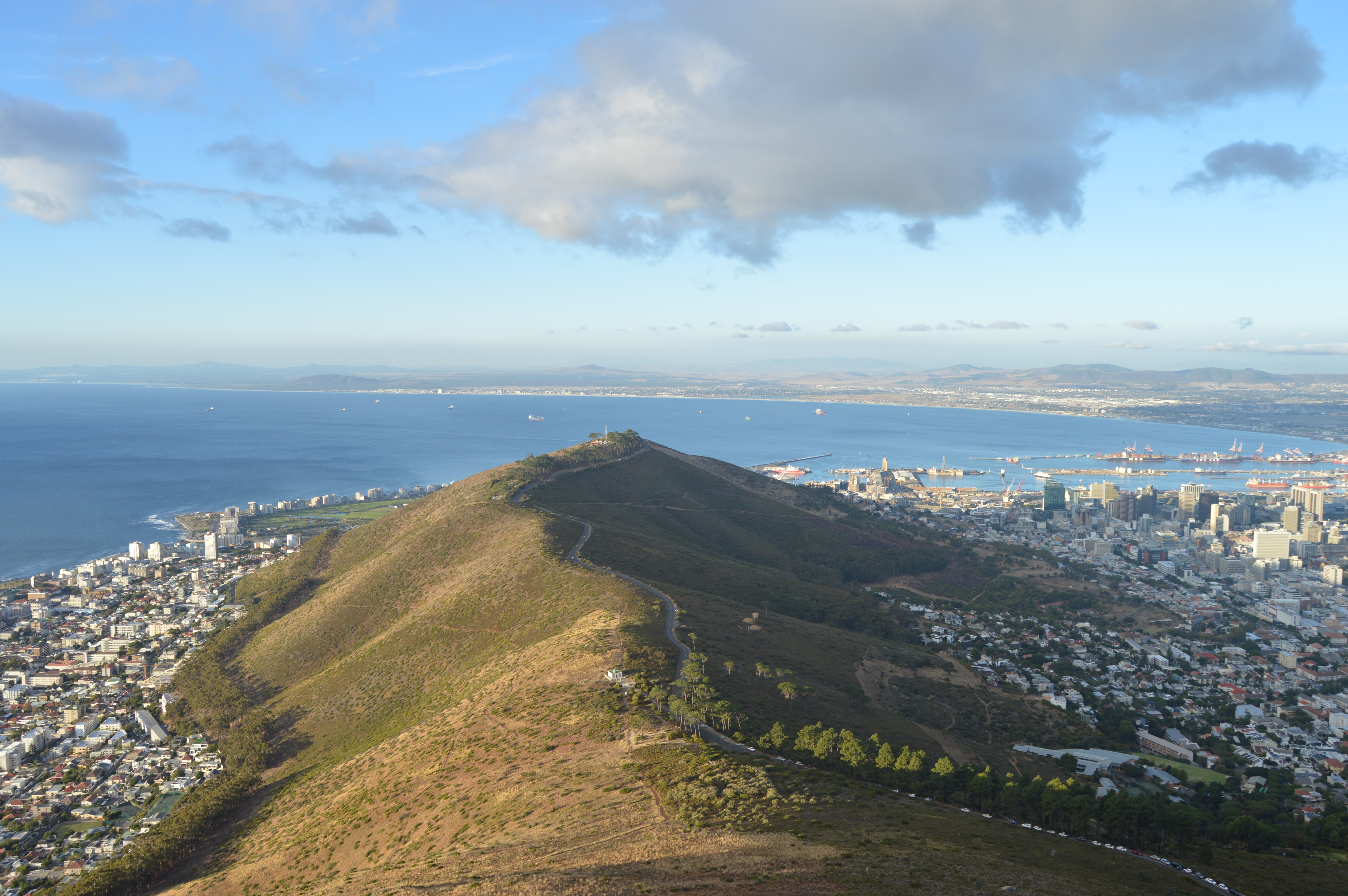
The M3 is the freeway that runs along the eastern side of Table Mountain, connecting the airport feeder routes and the southern suburbs (places like Constantia, Wynberg and Newlands) with central Cape Town. On the central-Cape Town end, the M3 narrows and descends through Hospital Bend, the long curve in the road below Groote Schuur Hospital where most morning traffic backs up. From there it drops past Devil’s Peak, the rocky eastern peak of the Table Mountain range, and into the eastern edge of the City Bowl.
As the freeway approaches the bottom of the slope, drivers reach a fork. They can either continue on the M3 into Buitenkant Street, which feeds into the CBD, or they can take the Mill Street off-ramp, which is the more popular evening choice for anyone going to the western half of central Cape Town. Once you commit to the off-ramp, the road curves north-west and ends at a traffic light on Mill Street.
Mill Street is the road that runs along the lower edge of the residential City Bowl. It separates the southern fringe of the Gardens neighbourhood from the strip of small offices and commercial buildings that eventually gives way to the CBD. The traffic light at the bottom of the off-ramp is the first hard stop a driver hits after leaving the freeway. The signal cycle is fixed and predictable.
Three features of this corner matter. First, drivers have just left an 80 km/h freeway and are decelerating into a 60 km/h urban grid. They are physically and mentally relaxed, which makes them slow to react. Second, the Mill Street Bridge Skatepark, a small open-air concrete skatepark, sits immediately east of the off-ramp, on the south side of Mill Street, tucked under the road bridge itself. The skatepark has bowls, low walls, ramps and pillars; the bridge above casts deep shadow even in daylight. Anyone standing in the skatepark at night is effectively invisible from the road. Third, the residential streets immediately south of Mill Street, including Maynard Street, Glynville Terrace and the gridiron of Vredehoek and Oranjezicht, give anyone leaving the corner on foot dozens of routes to disappear into.
Two further geographic points are worth noting. Drivers coming down the off-ramp cannot see into the skatepark, or see anyone standing in its shadow, until their car is already committed to the ramp. And the traffic light’s timing is fixed, which means anyone watching the corner over a few evenings can predict to the second how long the red lasts. Together, these features describe a small fixed location at which a foot group can stage out of sight, act when the light turns red, and disappear into a residential grid afterwards.
The CID coverage gap, explained
The single most important thing to understand about safety in central Cape Town is the role of City Improvement Districts. CIDs are not part of the police, and they are not part of the City of Cape Town. They are private companies funded by property owners in a defined neighbourhood, in exchange for added services on top of what the City and the police already provide. A typical CID runs a 24-hour control room watching CCTV cameras across the area, employs uniformed foot patrol officers, contracts an armed private response company to attend incidents, hires social workers to engage with the area’s homeless population, and pays cleaning crews to keep the public spaces tidy.
The Cape Town Central CID, often shortened to CCID, is the oldest and largest. It was established in 2000 by a group of CBD property owners frustrated by the post-apartheid decline of the city centre. Today the CCID covers 1.6 square kilometres of the traditional CBD, employs around 600 people through contractors, and runs a 24-hour control centre staffed every minute of the year. It is one of the main reasons the Cape Town city centre has felt safe enough to walk through, since the 2000s, that the city has become a tourist destination at all.
The catch is the boundary. The City’s CID by-law requires that everything a CID does happens strictly inside its boundary line. A CID cannot dispatch its officers across the street, even when “across the street” is two metres away. The boundary is the boundary. The CCID’s southern boundary is Buitensingel Street, roughly 250 metres north of Mill Street. South of Buitensingel, the CCID can do nothing.
That 250-metre strip between Buitensingel and Mill Street has been a known coverage gap for years. In 2025, a steering committee of Gardens property owners, residents and shop-owners proposed a new CID called the Lower Gardens CID to fill it. The draft business plan, available on the steering committee’s website, sets the proposed boundaries as Hatfield and St Johns Street on the west, Roeland Street on the north, and Annandale Street, Mill Street and Jutland Avenue on the south. The plan specifically lists the Mill Street Bridge as a foot-security deployment point. As of mid-2026 the CID is still going through the public-consultation and Council-approval process; it is not yet operating.
Here is the problem. Even if the Lower Gardens CID is approved tomorrow, its southern boundary stops at Mill Street. The off-ramp itself, the skatepark and the traffic light all sit on the south side of Mill Street, outside the proposed area. The boundary follows the centre line of the road. To close the actual hotspot, the new CID would need its southern boundary extended south of Mill Street, or the City would have to add CCTV and patrols on the south side through a separate route.
The chart below makes the geometry visible. Read it from top (north, towards the CBD) to bottom (south, towards Mill Street and the off-ramp). You can see the CCID at the top, the unCIDed belt below it, the proposed Lower Gardens CID below that, and finally the off-ramp landing zone south of Mill Street, which is in nobody’s territory.
A north-to-south slice of CID coverage in the City Bowl
Each band represents a strip of land north to south. Two of the four bands have no City Improvement District covering them. The off-ramp lands in the bottom band, which is south of every CID.
Why the streetlights stay broken
Drivers using the Mill Street off-ramp after dark have repeatedly complained that the lights along the inbound stretch are out for long sections. This is consistent with a separate, lesser-known problem that has been quietly worsening on Cape Town’s freeway off-ramps for years. The City of Cape Town maintains over 245,000 streetlights across the metro through its Energy Directorate, and that department has been on a vocal repair drive (10,000 lights repaired in a single month over the 2024 festive season; an aggressive rollout of LED replacements on the R27, M23 and parts of the N2). But the City’s own communications, in late 2024, contained a caveat most residents missed.
The City explicitly stated that “other national and provincial agencies are also responsible for some national roads that include off and on-ramps and this unfortunately impacts the burn rate of lights as the City of Cape Town does not manage certain routes.” Translated, the City does not own, fix, replace or repair the streetlights on freeway slip roads that are managed by national or provincial road agencies. The M3 is one of those routes. The lights on the Mill Street off-ramp are SANRAL infrastructure, not City infrastructure. City repair teams cannot legally touch them, and would not be authorised to even if they wanted to.
The lighting failure compounds two other problems. First, the M3 inbound drops drivers from open-sky freeway lighting into a poorly-lit urban grid; the eye takes several seconds to adjust to the change. Second, the Mill Street bridge casts a hard concrete shadow over the traffic light itself, which means even when the off-ramp lamps are working, the area where anyone waiting at the corner would actually stand is in deeper shadow than the road surface immediately around the stopped car. A person waiting in the bridge shadow is invisible to a driver until they step out.
None of this is fixable by any single body. The City of Cape Town can repair Mill Street’s lamps but not the off-ramp’s. SANRAL has the off-ramp but does not run a 24-hour control room for dark-spot interventions of the kind the City does. The CCID and the proposed Lower Gardens CID, as the previous section showed, are forbidden by their own bylaws from operating outside their boundaries. The result is an off-ramp that is, in practice, lit by nobody in particular.
V. The patternThe traffic-light robbery pattern across central Cape Town
The Mill Street junction is not an outlier in its precinct. The South African Police Service (SAPS), the country’s national police, runs a station at 28 Buitenkant Street, about 850 metres north of the off-ramp. This station, known as Cape Town Central, is the busiest SAPS station in the country. Its jurisdiction covers the entire CBD, the Foreshore, the lower edges of Gardens, parts of Bo-Kaap (the historic Cape Malay neighbourhood on Signal Hill) and a strip of Woodstock to the east.
On 6 March 2025, Cape Town Central held the first Community Police Forum meeting of the year. A Community Police Forum, or CPF, is a monthly public meeting where the precinct commander, crime-intelligence officers and residents discuss recent crime trends. They meet at 8 AM on the first Thursday of every month, at the police station itself. They are open to the public.
At the March 2025 meeting, the precinct’s crime-intelligence officer, Captain Armand Brink, reported that over the previous three months the precinct had seen an increase in both common robbery and, in February, aggravated robbery. He was specific about the modus operandi: “police were having constant issues at traffic lights in the city centre, where criminals grab victims’ cellphones through open windows of vehicles; chains are snatched, and victims of aggravated robbery are threatened mostly with knives.” The precinct’s commanding officer, Colonel Natasha Thomas, who chaired the meeting, separately flagged a sharp rise in carjacking, mostly involving e-hailing drivers (Uber and Bolt) who had been asked to drop a passenger off in a quiet part of the city at night and were then forced out of the vehicle.
The Mill Street off-ramp combines both signatures. A vehicle stopped at a red light is the geometry of the open-window cellphone grab. A vehicle stopped at a red light at night, with a multi-person foot group closing in, is the geometry of carjacking. Whether a particular group is targeting the phone on the dashboard or the car itself, the staging is the same.
Time of day matters. Cape Town’s smash-and-grab robberies, which are quick (typically four seconds), three-person operations focused on snatching valuables through a broken window, peak in two daily windows: 15:45 to 18:00 on the evening commute, and 06:15 to 07:30 in the morning. Aggravated robbery and carjacking peak later: 8 PM to midnight, particularly Thursday to Saturday. The chart below combines what is publicly reportable about both crime types into a single 24-hour intensity curve for the Cape Town Central precinct.
Hourly intensity of street-level robbery, Cape Town Central precinct
An indicative 24-hour distribution combining smash-and-grab and aggravated robbery. The morning and evening peaks are commuter smash-and-grab. The 20:00 to midnight window is carjacking and aggravated robbery. The Mill Street off-ramp incident at 8 PM in May 2026 sits at the start of the second peak.
How the hotspot took shape
The Mill Street off-ramp did not become a hotspot overnight. The combination of factors above (two CIDs whose boundaries end on the same street, an off-ramp the City does not light, a precinct already flagging traffic-light robberies as its leading concern) has assembled over the past decade. The dated points below trace the arc.
The Cape Town Central CID is established as central Cape Town’s first paid private-security zone. Its southern boundary is set at Buitensingel Street, about 250 metres north of Mill Street. Everything south of Buitensingel is, by design, outside CCID jurisdiction.
An armed robbery at the Nedbank branch inside the Gardens Shopping Centre, on Mill Street, is reported by News24. It is the second incident at the same shopping centre in three months. The shopping centre is about 200 metres west of where the off-ramp lands.
Loadshedding (the scheduled rolling power cuts South Africa used to balance grid demand) peaks. Many of Cape Town’s CCTV cameras and streetlights operate on intermittent grid power, and the City’s repair backlog grows. Driver complaints of “lights off for kilometres” on inbound freeway routes become, briefly, the default condition of after-dark Cape Town.
The City of Cape Town announces an aggressive LED streetlight rollout, beginning on the R27 in Sea Point and Green Point. The City notes in its own communications that “off and on-ramps” managed by national and provincial road agencies are excluded from its repair programme. The Mill Street off-ramp is one of those excluded routes.
At the first community police forum meeting of 2025, Cape Town Central SAPS reports that traffic-light cellphone-grabs and knife-led aggravated robberies are the precinct’s leading active concerns. The precinct also flags carjacking, particularly of e-hailing drivers in quiet parts of the city after dark.
A steering committee of Gardens property owners publishes a draft business plan for a Lower Gardens City Improvement District. The plan names theft from motor vehicle, common robbery and vagrancy as the precinct’s leading challenges, lists Mill Street Bridge as a foot-security deployment route, and sets the southern boundary at Mill Street. As of the publication of this article, the CID is not yet operating.
A first-person account posted to r/capetown describes a six-person foot approach at the Mill Street off-ramp traffic light, at approximately 8 PM. The driver reversed and exited via a one-way street. The account is consistent with the SAPS-flagged pattern from 2025, and is one of several traffic-light incidents reported in Gardens and the lower City Bowl over the past 18 months.
Practical advice for drivers using the off-ramp
The standard “lock the doors, hide valuables” advice does not adequately address what makes this junction risky. A two-sided foot approach neutralises locked doors and a clean dashboard. The advice below is drawn from South African private-security training and is calibrated to a fixed-spot traffic-light incident.
1. Avoid the off-ramp after dark
The most defensible position is not to be in the queue. If you are coming off the M3 inbound after 7 PM, consider staying on the M3 to the next exit (Buitenkant Street) and approaching the City Bowl through the CCID footprint, where CCTV and foot patrol coverage are denser. The detour adds about 90 seconds in moderate evening traffic.
2. Treat a red light as a yield, if it is safer
The South African National Road Traffic Act (Regulation 311) lets a driver treat a red traffic signal as a yield sign at night, when the driver reasonably believes a full stop would compromise safety. If the off-ramp light is red, the road ahead is clear, and you suspect a setup, proceed cautiously through the intersection. This legal protection is real, but it is reserved for genuine safety threats, not impatience.
3. Leave at least one car-length of space
Robbery crews exploit drivers who pull bumper-to-bumper. A car-length of clearance to the vehicle ahead is your escape buffer. From a full stop with a car-length, you can turn the wheel and accelerate around the car in front. From a bumper-stop, you cannot move.
4. Watch the side mirrors, not the windscreen
A two-sided incident often starts with a front-of-vehicle distraction. The people you should be watching most carefully are the ones in your side mirrors. If you see people moving toward your rear quarter, particularly in a pair or more, leave the intersection immediately by any legal route available. Do not wait for the green.
5. Limping strangers are not your problem
If a person approaches your stopped car on foot at night, feigning injury or distress, your default assumption should be that this is a distraction approach. Do not lower your window. Do not unlock the car. Call the police from inside the car, on speakerphone if you need to. Real injured pedestrians in Cape Town do not approach stationary motorists at night for help; they approach buildings, shops and security guards.
6. Save the right numbers in your phone
SAPS Cape Town Central: 021 467 8078 (24-hour station number). CCID 24-hour control centre: 082 415 7127 (only effective inside the CCID footprint, but the control room can dispatch to the boundary and coordinate with SAPS for incidents just outside). National emergency: 10111. Save all three before you need them; knowing which number to call shaves minutes off the response time.
What would close the hotspot
The good news is that the off-ramp problem is mechanically solvable. The bad news is that the solution requires three separate public bodies to coordinate, and none of them is currently in the lead. The minimum intervention required is short:
- SANRAL commits to a six-week audit and replacement of every streetlight on the M3 between Hospital Bend and the Mill Street off-ramp, and sets a 48-hour repair window for future outages. Cost estimate: R1.2 to R1.8 million for the audit and full LED replacement of the affected ramp section (about €62,000 to €93,000 or $73,000 to $110,000 at April 2026 mid-market rates), plus a small ongoing maintenance budget.
- The City of Cape Town’s Public Safety Department installs a static CCTV camera with night vision and licence-plate recognition on the Mill Street bridge, pointed at the traffic light. The City already operates a CCTV control room at its Transport Management Centre; one additional camera at this junction is a low-cost addition.
- The Lower Gardens CID steering committee, when the CID is approved, considers extending the southern boundary to include the Mill Street Bridge Skatepark and the off-ramp landing zone, even if this means coordinating with the City over the small wedge of public open space the skatepark occupies. A foot-patrol officer at the bridge between 7 PM and midnight, even just one, would change the risk calculation for anyone planning to wait at the corner.
None of these are individually expensive. The blocker is not money. It is the coordination cost of pulling SANRAL, the Western Cape Government, the City of Cape Town’s Energy and Public Safety departments, the CCID, the Lower Gardens CID steering committee, and SAPS Cape Town Central into the same conversation about a 200-metre stretch of road that none of them, individually, considers theirs.
Frequently asked questions
What exactly is a “CID” and why does it matter so much in this story?
Is Gardens generally safe to live in or visit?
Why doesn’t the City of Cape Town just fix the off-ramp lights?
Is reversing or driving through a red light to escape a robbery legal?
Should I use the Mill Street off-ramp at all?
Is the proposed Lower Gardens CID actually going to happen?
Are these incidents increasing across Cape Town?
Who do I report a similar incident to?
Sources & references
SAPS & community policing
- Capetowner, “Robbery, carjacking trends concern Central police” (Cape Town Central SAPS CPF meeting, Capt Armand Brink, Col Natasha Thomas; 7 March 2025) capetowner.co.za
- Cartrack South Africa, “Huge Increase in New Hijacking Hotspots in South Africa” (SAPS Q1 2024/25 carjacking statistics; July 2025)
- SAPS Cape Town Central station, 28 Buitenkant Street: 021 467 8078
City Improvement Districts
- Cape Town Central CID, “Talking boundaries” (CCID footprint: Buitensingel to FW de Klerk Boulevard, Buitengracht to Canterbury) capetownccid.org
- Lower Gardens CID, draft business plan 2025 (Hatfield/St Johns to Annandale/Mill/Jutland) lowergardenscid.co.za
- City of Cape Town, City Improvement District By-Law 2023
Street lighting & road jurisdiction
- City of Cape Town Energy Directorate, December 2024 streetlight statement (Alderman Xanthea Limberg; 245,000 lights maintained; “off and on-ramps” explicitly excluded as national/provincial routes)
- Cape Argus, “LED street lights roll-out in Cape Town” (8 August 2024)
- SANRAL (South African National Roads Agency Limited), road-jurisdiction documentation
Traffic-light robbery pattern
- Cape Town Today, “These Cape Town roads are smash-and-grab danger zones” (three-person crew model, peak-hour timing; April 2026)
- capetownetc.com, “Cape Town traffic officers thwart smash-and-grab crimes on N2 highway” (City of Cape Town Highway Deployment Ghost Units; March 2026)
Place verification
- Coordinates for Mill Street Bridge Skatepark (-33.9343, 18.4199), Gardens Shopping Centre (-33.9349, 18.4181) and SAPS Cape Town Central (-33.9276, 18.4232) verified via Google Places, May 2026
Image attribution
- No Wikimedia Commons image of the Mill Street off-ramp was identified for use in this article. The article uses no external photography.
You May Also Like
How safe is Clifton?
Photo courtesy of Warren Rohner, Wikimedia Commons, licensed under CC BY-SA 2.0 Atlantic Seaboard · Cape Town Is It Safe to Live in Clifton ,…
Read Article
Is Claremont Safe?
Cape Town Data · Safety Series Is Claremont Safe? A Data-Driven 2026 Guide Claremont is the commercial heart of Cape Town's southern suburbs, leafy on…
Read Article
The "Permit" Scam: How Card Cloners Are Targeting Tourists in Central Cape Town
Photo courtesy of Dietmar Rabich, Wikimedia Commons, licensed under CC BY-SA 4.0 Scam Alert · Central Cape Town · May 2026 The "Permit" Scam: How…
Read Article
Is It Safe to Live in Constantia, Cape Town?
Photo courtesy of Zaian, Wikimedia Commons, licensed under CC BY-SA 3.0 Southern Suburbs · Cape Town Is It Safe to Live in Constantia , Cape…
Read Article
Is It Safe to Live in Walmer Estate, Cape Town? 2025–2026 Safety Guide
Photo courtesy of Axxter99, Wikimedia Commons, licensed under CC BY-SA 4.0 City Bowl · Woodstock & East · Cape Town Is It Safe to Live…
Read Article