Where are Cape Town's Best Beaches?
April 27, 2026

_banner_Beach_panorama.JPG)
Cape Town's Best Beaches, Ranked
A locals-and-visitors guide to the 10 beaches worth your time, ranked on water temperature, wind shelter, and crowd density. Plus the rule for picking the right beach by today's wind direction.
The Cape Peninsula has roughly 150 km of coastline split between two oceans: the cold Benguela current on the Atlantic side, the warmer mixed waters of False Bay on the south-east. The choice between them is rarely about quality and almost always about today's wind. The infamous summer south-easter (the Cape Doctor) blasts the Atlantic Seaboard while False Bay sits in the lee, calm. Pick the wrong side and your beach day is sand-blasted misery; pick the right side and the same day is paradise.
This guide ranks ten beaches across both coasts, weighting water temperature, wind shelter and crowd density to produce a single editorial ranking. Eight Cape Town beaches hold full Blue Flag certification for the 2025/26 season – Bikini Beach, Camps Bay, Clifton 4th, Fish Hoek, Llandudno, Melkbosstrand, Muizenberg, and Silwerstroomstrand – and the local City of Cape Town runs 680+ lifeguards across 29 beaches in summer. Coordinates verified via Google Places. Sea-temperature ranges are pulled from multi-year averages of inshore SST observations.
Two coasts, two oceans, three different beach types
The Cape Peninsula's three distinct coastal zones each behave differently: water temperature, wave size, wind exposure, and crowd levels all swing dramatically depending on which side you're on.
Atlantic Seaboard
Cold, dramatic, photogenic. The Benguela current keeps water at 12-18 °C year-round. Camps Bay, Clifton, Llandudno. Mountains drop straight into the sea; sunsets are spectacular. Punishing on a strong south-easter – the wind funnels straight off Table Mountain. Most people don't swim long; they wade, photograph and have lunch.
False Bay
Warmer, gentler, family-friendly. 17-22 °C in summer – proper swimming temperatures. Muizenberg, Fish Hoek, Boulders, St James, Bikini Beach. The peninsula's spine blocks the south-easter, keeping these beaches calm when the Atlantic is blasted. Beginner surf, tidal pools, and the only beach in South Africa with a permanent shark exclusion net (Fish Hoek).
West Coast
Wide, windy, world-class for kitesurfing. Bloubergstrand, Big Bay, Melkbosstrand. The same south-easter that ruins Camps Bay creates 25-35 knots of consistent sideshore wind here from October to March – the global capital of kitesurfing. Also home to the iconic Table Mountain panorama view. Cold Atlantic water; not for sunbathing on summer afternoons.
The 10-beach matrix at a glance
The ranking weights wind shelter (45%), water suitability (30%), practical access (15%) and uniqueness of experience (10%). Scroll to compare; tap any beach below for the full profile.
| # | Beach | Coast | Summer °C | Shelter (SE) | Shelter (NW) | Blue Flag |
|---|---|---|---|---|---|---|
| 1 | Camps Bay Beach Atlantic Seaboard |
Atlantic Seaboard | 16-18 °C | 4/10 | 7/10 | YES |
| 2 | Clifton 4th Beach Atlantic Seaboard |
Atlantic Seaboard | 15-17 °C | 9/10 | 4/10 | YES |
| 3 | Muizenberg Beach False Bay |
False Bay | 19-22 °C | 8/10 | 3/10 | YES |
| 4 | Llandudno Beach Atlantic Seaboard |
Atlantic Seaboard | 14-17 °C | 7/10 | 6/10 | YES |
| 5 | Boulders Beach False Bay |
False Bay | 18-21 °C | 9/10 | 7/10 | No |
| 6 | Fish Hoek Beach False Bay |
False Bay | 18-21 °C | 7/10 | 4/10 | YES |
| 7 | Bikini Beach Gordon's Bay (eastern False Bay) |
Gordon's Bay | 20-22 °C | 9/10 | 6/10 | YES |
| 8 | Bloubergstrand West Coast (Atlantic) |
West Coast | 15-18 °C | 1/10 | 5/10 | No |
| 9 | St James Tidal Pool & Dalebrook False Bay |
False Bay | 18-20 °C | 8/10 | 5/10 | No |
| 10 | Noordhoek (Long Beach) Atlantic Seaboard south |
Atlantic Seaboard south | 14-17 °C | 5/10 | 6/10 | No |
Shelter scores: 10 = fully calm in that wind direction · 1 = directly exposed. SE = south-easter (summer prevailing); NW = north-wester (winter cold fronts). See the data section for monthly water temperatures.
All 10 beaches on one interactive map
Markers are colour-coded by coast: teal = Atlantic, gold = False Bay, red = West Coast. A small green dot indicates Blue Flag certification for 2025/26. Click any pin for water temperature, wind shelter score, and direct Google Maps directions.
Cape Town's 10 best beaches, plotted
Tap any marker to open its profile, with one-click Google Maps directions. Use the sidebar list to fly to any beach.
Tip: sort by coast in your head – False Bay markers (gold) cluster on the south-east, Atlantic markers (teal) on the west. The further apart they are, the more they swap places by wind direction.
Open full map in new tabSea temperature & wind shelter, charted
Two questions drive every Cape Town beach decision: how cold is the water, and where can you escape the wind today. The first is seasonal and predictable; the second changes hour by hour.
Monthly sea temperature: Atlantic vs False Bay vs Gordon's Bay
Multi-year inshore averages from seatemperature.net and SAWS data. The False Bay zone runs 5 to 7 °C warmer than the Atlantic Seaboard year-round; Gordon's Bay (Bikini Beach) is the warmest swim on the peninsula.
Linear scale verified: 1 °C = 20.67 px on Y-axis (uniform); 1 month = 54.5 px on X-axis. December to March is the only window when False Bay water is warm enough that most non-locals will swim freely (≥19 °C); the Atlantic stays below 18 °C even at peak.
Wind shelter from the south-easter, by beach
A 0-10 score combining geographic exposure to the prevailing summer SE wind, observational reports, and surfer/kitesurfer wind ratings. Higher = more sheltered.
Uniform scale: 1 point = 42 px. The four highest-scoring beaches (Bikini, Boulders, Clifton 4th, Muizenberg) all sit in the wind-shadow of either the peninsula spine or specific granite formations. Bloubergstrand scores 1/10 deliberately – that's its appeal for kitesurfers, who want the wind howling.
Profiled, ranked, with verified coordinates
Each beach below has a verified address and Google Places coordinate for navigation. Tap the "Open in Maps" pill to launch directions. Beaches are colour-coded by coast: teal = Atlantic, gold = False Bay, red = West Coast.
The most photographed beach in South Africa. Wide, accessible, lined with palm trees and bistros. Great in still air, miserable in a strong south-easter.
Camps Bay is the beach almost every visitor sees first. The strip runs flat from the Promenade right onto the sand, which is rare in Cape Town and makes it the only Atlantic beach with genuinely step-free wheelchair access. The 12 Apostles loom directly behind. A long row of cocktail bars, bistros and ice-cream shops faces the beach across Victoria Road, which is part of why it's busy all day in summer.
The water is properly cold – Atlantic, Benguela current, 15-17 °C in February, single digits in winter wind chill. Most people don't swim; they wade, photograph, and have lunch. Sunset is the standout – the sun drops behind the horizon line, the Apostles light up amber, and the whole strip turns gold.
On a strong south-easter day, Camps Bay can be uncomfortable for hours – the wind funnels down off the mountain straight onto the sand. The Twelve Apostles soften some of the gusts on the southern end, which is a touch calmer than the main strip. Blue Flag for 2025/26.
The single most reliable Atlantic beach when the south-easter is blowing. Granite boulders block the wind almost completely. Parking is brutal.
Clifton's four coves sit in the lee of Lion's Head, separated from each other by granite outcrops that block the south-easter so effectively that you can be sunbathing in still air at Clifton 4th while Camps Bay (1.5 km south) is being sandblasted. This is the rule for any south-easter day in summer: when in doubt, head for Clifton.
Clifton 4th is the largest, flattest and most accessible of the four – chair rentals, ice cream, lifeguards, the only Blue Flag beach in the Clifton group. The water is cold but flat. Families pile in here while the unsheltered Atlantic beaches sit empty.
The catch is parking. Victoria Road has a few dozen bays for a beach that draws thousands; on a 30 °C summer Saturday you may circle for 45 minutes. The car-guard ecosystem is established and reliable, but you need to budget time. Walking down from the top of Kloof Road or being dropped off is the local move.
The warmest swim on the peninsula and South Africa's most famous beginner-surf spot. Year-round Shark Spotters, lifeguards in summer, dense surf-school presence.
Muizenberg is the closest a Cape Town beach gets to genuinely warm – 19-22 °C in summer, which on the Atlantic side would be unheard of. The bay opens onto False Bay; the sun warms the upper water layer, and the south-easter pushes that warm layer toward shore. People actually swim here.
Surfers Corner – the eastern end with the colourful changing huts that anchor every Cape Town postcard – is the country's most-used beginner break. A dozen surf schools operate from the strip. Boards rent for around R150/day; lessons R450-650. The wave is forgiving, sand-bottomed, mellow. Shark Spotters watch from the mountain 365 days a year; flag colours signal current risk.
The crowd is the most diverse of any Cape Town beach – surfers, families, visitors, swimmers, dog walkers, students, the lot. Parking along Beach Road is generally manageable. Blue Flag 2025/26.
Granite cove tucked between Hout Bay and Camps Bay. No restaurants, no kiosks, no buses – just sand, boulders and surf. Where Capetonians actually go.
Llandudno is the Atlantic beach that locals choose when they have a free Saturday. There is no commercial frontage – no bars, no shops, no tour buses. The cove is ringed by granite boulders that frame Lion's Head views; the sand is white and steep; the wave is a punchy beach break that's drawn surfers since the 1960s.
The Sentinel headland to the south blocks the worst of the south-easter on most days. It's not as bulletproof as Clifton 4th, but it stays usable when Camps Bay is unbearable. The water is the same cold Atlantic – bring a wetsuit if you intend to swim more than 60 seconds.
Parking is the single hardest thing about Llandudno. The street loops down to the beach with a few dozen marked bays; on summer weekends they're full by 09:30. Most visitors park up the hill and walk down. Blue Flag 2025/26 – and one of only three Cape Town Blue Flag beaches with no toilet block, which is part of the locals-only feel.
Granite-cove beach inside Table Mountain National Park, home to a colony of African penguins. Sheltered, warm-ish, perfect for kids – but you pay to enter.
Boulders sits inside Table Mountain National Park, just south of Simon's Town. The granite outcrops that give the beach its name break the sea into a series of small, sheltered coves – perfect for kids, snorkelling, and floating on a warm afternoon. Same coves shelter the African penguin colony that has lived here since 1982 and grown to over 2,000 birds.
Day-visitor entry to the penguin viewing boardwalk and adjacent beach access (Foxy Beach) requires a SANParks fee; the small adjacent beach where you can swim alongside the colony is reached via a separate path and the same ticket. Don't approach the penguins – they bite, and the rangers are firm. Bring water shoes; the granite is slippery in places.
Sheltered from both summer and winter winds. Water is markedly warmer than the Atlantic – typically 18-21 °C in peak summer. Crowds are heavy in mid-season; arrive at opening (08:00) for a calmer experience. Not a Blue Flag beach because it's a national-park reserve, not a managed swimming beach.
Sheltered horseshoe bay, shark exclusion net deployed in summer, lifeguards, easy parking, easy beach. The most family-friendly beach on the Cape.
Fish Hoek Bay is a near-perfect arc of sand cradled between Elsies Peak (north) and Trappies Kop (south). The bay shape blocks swell, calms surf, and produces the gentlest wave on the Cape. The award-winning shark exclusion barrier – the only one of its kind in South Africa – has been deployed every summer since 2013; no shark-related fatality at Fish Hoek since 2011.
All of which makes this the default Cape Town beach for families with small children. Lifeguards in summer, ample parking along Beach Road, public toilets, a coffee shop and a fish-and-chips joint. The water is False Bay's warmer side – 18-21 °C in summer.
The southerly Jagger's Walk, a paved seaside path running south from the beach to Sunny Cove, is a beautiful 1.5 km stroll – the best non-beach reason to visit. Blue Flag 2025/26.
Tiny tucked-away beach in Gordon's Bay, sheltered by the marina wall on one side and the Hottentots Holland mountains on the other. The Cape's warmest water, year-round.
Gordon's Bay is 50 km east of central Cape Town – beyond the airport, past Strand, where the Hottentots Holland mountains tip into False Bay. Bikini Beach is the small, almost-hidden cove right next to the harbour wall in the village. The wall blocks the south-easter completely; the mountains block the north-wester. The result is the most reliably wind-free beach in the Cape.
It also has the warmest swimming water on the peninsula – 20-22 °C in summer, regularly hitting 23 in February. Tourists rarely make it out here, so the beach has a local-village feel. Lifeguards in summer, public toilets, a row of cafés up the road. Blue Flag 2025/26.
The drive from Cape Town CBD takes 50 minutes outside peak hour. If you're combining with Stellenbosch wine farms (a 25-minute hop further inland), Gordon's Bay makes a logical end-of-day swim.
8 km of Atlantic coast facing directly back at Table Mountain. Cape Town's most-photographed mountain view. World-class kitesurfing on south-easter days.
Bloubergstrand sits 25 km north of Cape Town along the West Coast. Its single most distinctive feature is the view: looking south, you see the entire Table Mountain massif – Lion's Head, Devil's Peak, the table top – across Table Bay. Almost every iconic Table Mountain panorama you've seen was shot from here.
The beach is also the global capital of kitesurfing. The same south-easter that makes Camps Bay miserable blows here at 25-35 knots, sideshore, almost daily from October to March. Big Bay (just north) and Kite Beach (further on) host the annual King of the Air kitesurf event. Watching from shore is half the appeal.
If you want to swim, pick a windless day or go in winter – the wind is the whole point of the beach for most of the summer, and that's exactly what makes it unsuitable for sunbathing. Parking is plentiful along Marine Drive; restaurants and cafés line the strip. Not Blue Flag certified – it doesn't aspire to that experience.
A pair of Victorian-era stone tidal pools between St James and Kalk Bay. Cold morning plunges, no waves, the iconic colourful changing huts. Atmospheric in any weather.
St James's tidal pool, with its row of brightly-painted Victorian changing huts, is the second-most-photographed beach scene in Cape Town after Muizenberg's. The pool was carved into the rocks in 1907 and is filled with fresh seawater on every high tide. No waves, no current – just calm, cold (15-18 °C) saltwater.
Dalebrook Tidal Pool, 400 m south, is the same idea without the changing huts – quieter, smaller, beloved of cold-plunge regulars who turn up at sunrise year-round. Both pools are connected by a paved seaside path that runs all the way to Muizenberg in one direction and Kalk Bay in the other.
Neither pool has lifeguards. They're not Blue Flag – they're heritage features rather than swimming beaches. But on a summer morning before the wind picks up they're hard to beat. Photographers should arrive 30 minutes before sunrise for the warm-light shot of the changing huts.
An 8 km wild Atlantic beach south of Chapman's Peak. Best in Cape Town for long walks and horseback rides. Genuine crime risk away from the main car park – go in groups.
Noordhoek Long Beach runs from Chapman's Peak all the way south to Kommetjie. Eight kilometres of wide, flat sand backed by dunes and the Noordhoek wetlands. The beach is so big that even on a busy summer Sunday it can feel half-empty 200 m from the car park.
It is the standout beach for horseback riding – operators like Sleepy Hollow run guided rides on the open sand year-round. Long beach walks, kite-flying, dog-walking on the leash sections. The water is rough, cold and currents are unforgiving – this is not a swimming beach, and the tragic incidents that make annual headlines tend to involve people who tried.
The crime caveat is real and well documented. The middle and southern sections (around the Kakapo shipwreck and onward to Kommetjie) have a 20-year record of armed muggings of solo walkers, especially around dawn and dusk. Stay near the main car park at the northern end, walk in groups of four or more, never carry valuables, never go at dawn or dusk alone. Our dangerous beaches piece covers the detail.
How to choose a beach by today's wind
The single most useful skill for any Cape Town beach day is reading the wind direction first and the temperature second. Here is the working rule used by every local who's been here more than a few summers:
Which beach for which kind of day?
If you only have time for one beach
What every beach day needs
Tips that actually change the day
- Check the wind direction first, the forecast temperature second. A 28 °C day with a 35-knot south-easter is unusable on the Atlantic Seaboard.
- Park before 09:30 in summer. Clifton, Llandudno and Boulders parking fills by mid-morning; circling for 45 minutes is real.
- Leave nothing visible in the car – not a phone, not a jacket, not an empty bag. Smash-and-grab is the most consistent beach-related crime in Cape Town.
- For Boulders and Cape Point, book SANParks tickets online in advance. Walk-up queues during peak season can run an hour.
- Take a wetsuit (or rent one) for any Atlantic-side swim longer than 60 seconds. 14 °C feels colder when you're not used to it.
- Swim only between the red-and-yellow flags. Every fatal drowning in Cape Town's 2025/26 season happened outside designated zones. Use the dangerous-beaches guide for context.
- Reef shoes for Boulders. The granite is slippery in places, especially at low tide. Inexpensive water shoes save the day.
- Sunset planning: in summer the sun sets around 19:55; in winter, 17:45. Arrive at least 45 minutes early to claim a spot at Camps Bay.
What's happening on Cape Town's beaches this season
Recent stories from Cape Town's coastline
The Wildlife and Environment Society of South Africa (WESSA) confirmed full Blue Flag certification for Bikini Beach, Camps Bay, Clifton 4th, Fish Hoek, Llandudno, Melkbosstrand, Muizenberg and Silwerstroomstrand for the season running 1 December 2025 to 28 February 2026. Each beach must meet 33 international criteria covering water quality, lifeguard presence, environmental education and accessibility.Source: WESSA press release · False Bay Echo
The City of Cape Town reported 5 fatal drownings over the 2025/26 festive season, down from 11 the previous year. Lifeguards prevented 23 near-drownings. The Identikidz programme tagged 101,780 children at 12+ beaches, reuniting 227 lost children with families. All five fatalities occurred outside designated bathing areas.Source: capetowndata.com dangerous-beaches analysis · City of Cape Town
A nine-person mass rescue at Kleinmond Main Beach in late January, conducted entirely using NSRI Pink Rescue Buoys, prompted renewed warnings about rip-current spikes during spring tides along the Western Cape coast. NSRI now has 230+ documented Pink Rescue Buoy saves nationwide.Source: NSRI
SANParks reported the African penguin colony at Boulders Beach stable at roughly 2,000 individuals, down from a 1990s peak but holding steady against species-wide decline. New 2025/26 access rules tighten distance from penguins on the boardwalk and at Foxy Beach.Source: SANParks Table Mountain
Shark Spotters's 2024/25 annual report confirmed essentially zero confirmed inshore white-shark sightings in False Bay for the fourth consecutive year, down from a 2010-2016 average of ~205 sightings/year. The collapse is attributed to predation by orca pair "Port and Starboard" and reduced prey availability from commercial longlining. Bronze whalers are now the dominant inshore species.Source: Shark Spotters annual report
Researchers and Daily Maverick reported continuing concerns over coastal water quality at non-Blue Flag sections of Cape Town coastline, particularly around stormwater outfalls. The City conducts ongoing enterococci testing at certified beaches; all 8 Blue Flag beaches scored "good" or "excellent" on every 2025 sampling round.Source: Daily Maverick
Cape Town beach questions, answered
What's the warmest beach for swimming in Cape Town?
Bikini Beach in Gordon's Bay is consistently the warmest swim on the Cape Peninsula, hitting 22 °C in February. The harbour wall and Hottentots Holland mountains shelter it from both prevailing winds. Muizenberg and Fish Hoek are 1-2 °C cooler but easier to reach from central Cape Town.
Can you swim at Camps Bay or Clifton?
Yes, but the water is genuinely cold – 14-17 °C in summer. Most people wade to their knees and retreat. Atlantic-side cold-water swimmers wear wetsuits or steel themselves for short dips. For actual swimming, head to False Bay (Muizenberg, Fish Hoek, Bikini Beach) where summer water reaches 19-22 °C.
Which beach is best when the south-easter is blowing?
The single most reliable south-easter shelter is Clifton 4th – granite outcrops and Lion's Head block the wind almost completely while Camps Bay 1.5 km south is being sandblasted. False Bay beaches (Muizenberg, Fish Hoek, Boulders, Bikini Beach) sit in the wind-shadow of the peninsula spine and stay calm on the same day. The capetowndata.com live wind dashboard recommends a beach by today's actual wind direction.
Is Muizenberg safe for beginner surfing?
Yes – arguably the safest beginner-surf beach in South Africa. The wave is sand-bottomed, gentle, and the bay is sheltered. Shark Spotters watch year-round and have recorded zero confirmed white-shark sightings in False Bay since 2018. A dozen surf schools operate from the Surfers Corner strip; lessons typically R450-650 with board and wetsuit included.
Do I really need to pay to see the penguins at Boulders?
Yes – Boulders Beach sits inside Table Mountain National Park, and SANParks charges a day-visitor fee for boardwalk access (Foxy Beach viewing area) and adjacent beach swimming. The fee includes both. If you want to see the penguins for free, walk along the road north of the entrance – you'll spot them in gardens. Better still: Stony Point in Betty's Bay (~1.5 hr drive) has more penguins, similar boardwalk experience, and is significantly cheaper.
Is Noordhoek Long Beach safe to walk?
The northern end (near the main car park, in sight of Chapman's Peak) is generally safe in daylight with other people around. The middle section (around the Kakapo shipwreck) and southern end toward Kommetjie has a 20-year record of armed muggings of solo walkers, especially at dawn and dusk. Walk in groups of four or more, in daylight, with no valuables. Our dangerous-beaches piece covers the detail.
When are lifeguards on duty?
The full lifeguard programme (680+ lifeguards across 29 City beaches) runs roughly December through March. Outside summer, only a handful of beaches have lifeguard presence, typically weekends only. Blue Flag beaches must have lifeguards present during their certified season (1 December to 28 February). Always check the day's flags; never swim if no lifeguards are visible.
Sources & references
Wikipedia articles for each beach
- 1. Camps Bay: en.wikipedia.org/wiki/Camps_Bay
- 2. Clifton: en.wikipedia.org/wiki/Clifton,_Cape_Town
- 3. Muizenberg: en.wikipedia.org/wiki/Muizenberg
- 4. Llandudno: en.wikipedia.org/wiki/Llandudno,_Cape_Town
- 5. Boulders Beach: en.wikipedia.org/wiki/Boulders_Beach
- 6. Fish Hoek: en.wikipedia.org/wiki/Fish_Hoek
- 7. Bikini Beach (Gordon's Bay): en.wikipedia.org/wiki/Gordon's_Bay
- 8. Bloubergstrand: en.wikipedia.org/wiki/Bloubergstrand
- 9. St James: en.wikipedia.org/wiki/St_James,_Cape_Town
- 10. Noordhoek: en.wikipedia.org/wiki/Noordhoek
Sea temperature data
- SeaTemperature.net – multi-year inshore SST observations
- South African Weather Service (SAWS) marine reports
- SeaTemperature.org – Atlantic-side averages
Wind & weather
- Wikipedia: Cape Doctor (south-easter)
- capetowndata.com live wind dashboard
- Wavescape.co.za surf and wind forecasts
Blue Flag & safety
- WESSA 2025/26 Blue Flag announcement
- National Sea Rescue Institute (NSRI)
- Shark Spotters annual reports
- capetowndata.com dangerous-beaches analysis
News coverage
- IOL Cape Argus / Cape Times · Daily Maverick · Cape Town Etc · False Bay Echo
- Getaway · Good Things Guy · The South African
Cape Town's coastline rewards the prepared. Read the wind, pick the right side of the peninsula, leave nothing in the car, and any of these ten beaches will give you a day worth remembering.
You May Also Like

Where to get married in Cape Town and Western Cape? And how much does it cost?
Wedding Economics · Cape Town & Winelands Choosing the Right Wedding Venue in Cape Town: A Data-Driven Guide You have pictured this day for most…
Read Article
What to Do in Cape Town in 3 Days?
Winter 2026 · Whale-season edition · Cape Town What to Do in Cape Town in 3 Days: Four Zones, One You Choose Three days is…
Read Article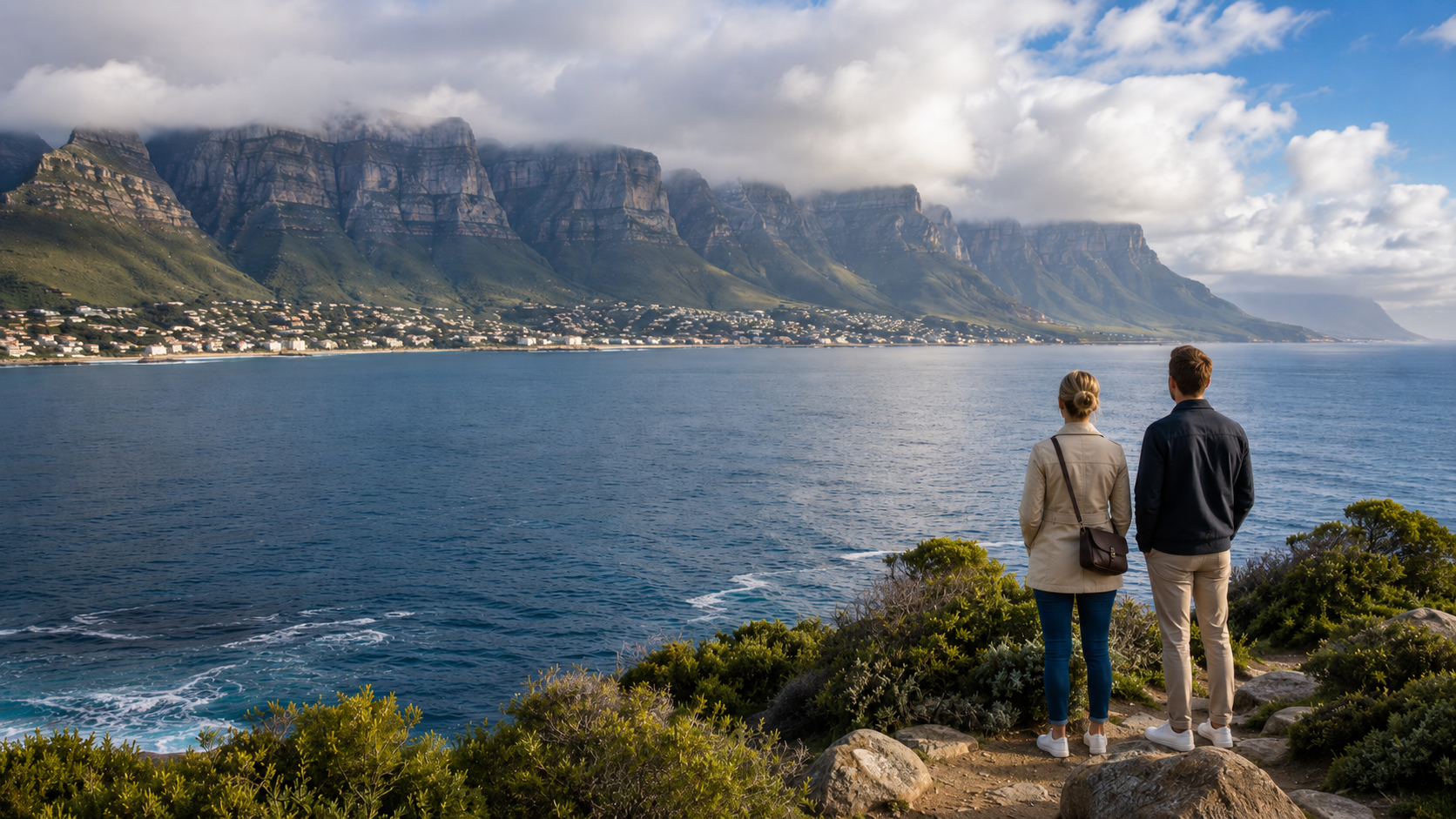
What to Do in Cape Town in Winter?
Travel Guide · The Secret Season · Cape Town What to Do in Cape Town in Winter Cape Town's winter, from June to August, is…
Read Article
What are the most important Historical Buildings & Places in Cape Town?
Photo courtesy of Ossewa, Wikimedia Commons, licensed under CC BY-SA 3.0 Heritage · Cape Town · April 2026 Edition 10 Historical Buildings & Places in…
Read Article
Cape Town Markets
🧺 Market Guide 2026 Cape Town Markets Artisan food, sunset picnics, live music, and street-level culture — your guide to the seven markets and events…
Read Article