Silvermine Panorama Circuit: The Most Underrated Hike Above Cape Town
November 22, 2025
Cape Town • Table Mountain National Park • Hiking Guide
Silvermine Panorama Circuit: The Most Underrated Hike Above Cape Town
Hidden between the better-known climbs of Table Mountain and Lion’s Head, the Silvermine Panorama Circuit might be the most beautiful “everyday” hike in Cape Town. It gives you a full sweep of both False Bay and the Atlantic, a quiet dam to swim in, and endless fynbos—without the crowds or cableway bustle of the city-front routes.
Quick take: The Silvermine Panorama Circuit is a medium-length loop from the Silvermine reservoir that combines easy paths, short rocky scrambles and big views over both oceans. It’s inside a controlled section of Table Mountain National Park with gate hours and an entrance fee, so it feels quieter and more managed than the free-access city-side trails. Crime on the mountain is still a real issue, but Silvermine has historically seen fewer incidents than some hotspot areas—though there have been muggings here too, so you still need to plan sensibly.
Loop from Silvermine Dam (Gate 1) Distance: ~10–11 km Ascent: ~400–500 m Time: 3.5–5 hours Best for: fit beginners to intermediate hikers Terrain: good paths, short rocky sections
Details are approximate. Always check current weather, fire warnings, gate hours, closures and safety advisories from SANParks / Table Mountain National Park before you go.
Why Silvermine feels like Cape Town’s most underrated hike
Silvermine Nature Reserve sits in the middle of the Cape Peninsula mountain chain, between the Kalk Bay mountains and Constantiaberg. It’s part of Table Mountain National Park and protects a big swathe of montane fynbos, with ridges, caves, a historic reservoir and a river that runs all the way to the sea.
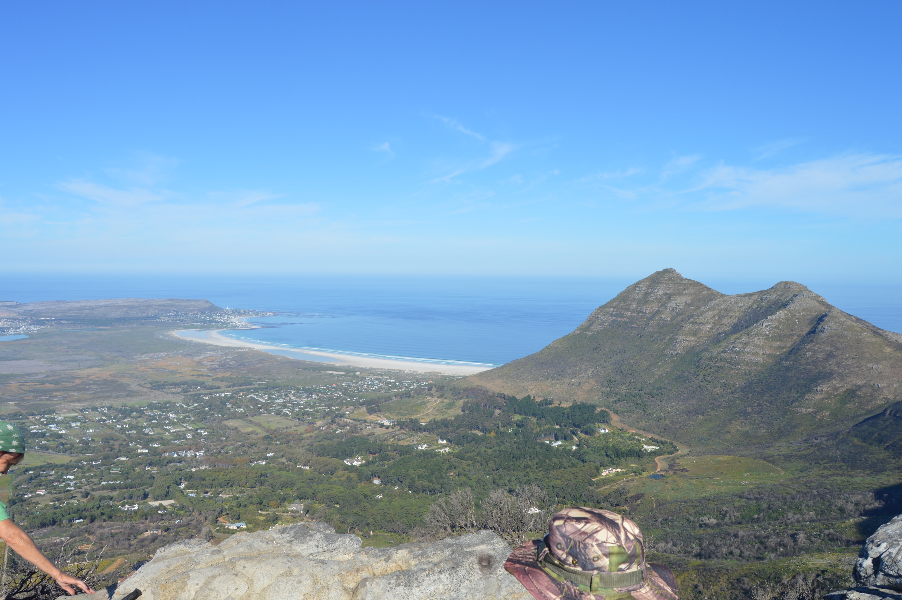
Most visitors head for the boardwalk around the reservoir, a picnic table and maybe a swim in the tea-coloured water. The Panorama Circuit goes much further. From the dam it climbs onto the rim above Noordhoek, swings past rocky viewpoints that feel like balconies over the Atlantic, and then curves back across the Silvermine amphitheatre with long views to Muizenberg, False Bay, Table Mountain and Devil’s Peak.
In April 2025, a major wildfire burnt through parts of Silvermine and Tokai, damaging infrastructure and closing many trails. Access has been reopening in phases: by late 2025, Gate 1, the dam area and key hiking routes such as Noordhoek Peak and the Panorama Circuit are open again, with some facilities still under repair. Always check the latest SANParks updates if you’re hiking soon after fire seasons.
What makes this loop underrated is the mix:
- You get “big mountain” panoramas without the relentless gradient of Platteklip or the exposure of India Venster.
- You start and finish at your car inside a gated reserve with toilets, braai spots (some still reopening after fire) and a dam to swim in afterwards.
- You share the route with local hikers, trail runners and a few dogs rather than a crush of international tour groups.
On a clear day after rain, the fynbos feels freshly washed and the skyline views stretch from Cape Point to Table Mountain. On a moody day, mist can pour over the ridges and the reservoir looks like something from a Scottish glen. Either way, the scenery-to-effort ratio is very hard to beat.
Route overview & stats: Silvermine Panorama / Highlights Circuit
There are many ways to stitch together a Silvermine hike. This guide focuses on a loop often called the Silvermine Highlights Circuit or Panorama Route: a clockwise circuit from the main dam car park that visits the amphitheatre above the reservoir, the Noordhoek lookout points and (optionally) the summit of Noordhoek Peak (~769 m).
| Aspect | Details (approximate) |
|---|---|
| Distance | About 10–11 km in total, depending on exact variations and whether you include the short out-and-back to Noordhoek Peak. |
| Elevation gain | Roughly 400–500 m of ascent from the reservoir to the ridge and peak, then rolling terrain along the skyline. |
| Time | Plan on 3.5–5 hours of walking time, plus breaks for photos, snacks and perhaps a swim at the dam. |
| Terrain | Good single-track and jeep track, some stone steps, short rocky sections and occasional sandy patches; no sustained scrambling on the standard loop. |
| Navigation | Marked paths and signboards, but there are many intersecting routes—having a GPS track or map app is reassuring, especially in mist. |
| Start/finish | Silvermine Gate 1 (dam side) car park off Ou Kaapse Weg, about 25–30 minutes’ drive from central Cape Town. |
| Highlights | Views over Noordhoek, Chapman’s Peak and Hout Bay; False Bay and Muizenberg; the reservoir and amphitheatre; carpets of fynbos and seasonal flowers, especially after fire. |
Typical loop, step by step
- Dam car park to amphitheatre rim: Follow signs uphill from the reservoir on clear paths to gain the ridge above the amphitheatre.
- Traverse towards Noordhoek: Contour westwards on single-track, with increasing views over Noordhoek and Chapman’s Peak.
- Noordhoek Peak spur (optional but recommended): A short side trip leads to the trig beacon with huge views over both bays.
- Return via the amphitheatre: Loop back across the high plateau, then drop towards the reservoir on one of several signposted paths.
- Cool down at the dam: Finish with a picnic and, in warm weather, a quick swim in the tea-coloured water (at your own risk).
Access, permits & entrance fees
Unlike city-side routes such as Platteklip Gorge, Silvermine is a pay point inside Table Mountain National Park. That means gate hours, vehicle control and a conservation fee—but also toilets, staff and a generally more managed feel.
Gates & sections
- Gate 1 (dam side): Turn right off Ou Kaapse Weg if you’re coming from the city. This is the trailhead for the reservoir, Panorama Circuit, Noordhoek Peak and many other hikes. It has formal parking and picnic sites.
- Gate 2 (east side): A little further along Ou Kaapse Weg on the other side of the road, with access to routes towards Kalk Bay, the waterfall, Steenberg Plateau and the Tokai side.
Entrance fees (guide only)
Conservation fees for the Silvermine section are broadly in line with other Table Mountain National Park pay points. As a rough guide:
- South African residents pay a day visitor fee in the tens of rand per adult (less for children).
- International visitors pay a higher day visitor fee, roughly a few times the local rate.
- Holders of certain Wild Cards or local “My Green Card” products may get covered entry at TMNP pay points.
Exact fees change regularly and may differ by season or product, so always check the latest figures on the SANParks or Table Mountain National Park website before you go.
- As of late 2025 there are no credit-card facilities at the Silvermine entrance gate—carry enough cash or confirm current payment options in advance.
- Dogs are allowed with a valid TMNP dog-walking permit; check current rules for leads, zones and restricted areas.
- Swimming in the reservoir is allowed but explicitly “at your own risk”; there are no lifeguards on duty.
When to go: seasons, gate hours & best time of day
Silvermine is open year-round, but the quality—and safety—of your day out will depend a lot on timing.
Gate hours
Gate times can change, especially after fires or during special operations, so always confirm them close to your trip. As a rule of thumb:
- Gate 1 (dam side): Typically operates on a “sunrise to sunset” pattern, with precise opening and closing times posted at the gate and on SANParks channels.
- Gate 2 (Steenberg Plateau / Kalk Bay side): Often has more fixed hours, commonly opening around 08:00 with exit required by early evening.
Treat these as ballpark guidelines only. Check SANParks / TMNP for the latest seasonal times before you set out.
Seasons & weather
- Late autumn & spring: Often the sweet spot. Cooler temperatures, greener slopes and crisp views after cold fronts. You may get some rain, but also some of the clearest days of the year.
- Summer (Dec–Feb): Long days and warm water in the dam, but the famous Cape south-easter wind can be ferocious on the ridges, and midday heat is no joke.
- Winter (Jun–Aug): Short days and more regular cold fronts. Locals still hike, but you need good layers and to respect wet, slippery rock and the risk of low cloud.
Best time of day
- Start early but in daylight: A departure between 08:00 and 09:30 generally balances cooler temps, more people on the trail and full daylight.
- Avoid late starts: In winter, starting after midday risks bumping into gate closing times. In summer, late starts mean crossing exposed ridges in the hottest hours.
- Plan to be off the ridges well before dark: This keeps both navigation and crime risk down.
Safety & crime: how risky is Silvermine, really?
Any honest guide to hiking around Cape Town has to talk about crime as well as cliffs and weather. Table Mountain National Park has hundreds of kilometres of trails and sees millions of visits per year. Most of those visits are incident-free. But robberies and attacks on hikers do occur, including in areas once thought “safe”.
The bigger picture: Table Mountain crime trends
- Recent media reports citing SANParks figures mention around dozens to low hundreds of robberies per year across the whole park. Totals fluctuate by year and by how incidents are counted, but they are high enough that safety deserves planning.
- Crime is not evenly distributed. Some sectors and routes—such as parts of the city-front gorges, Signal Hill and specific coastal paths—see repeated clusters of incidents, prompting campaigns like #SaveTableMountain and extra patrols.
- Even at their worst, these numbers are small compared with total visitor days—but much higher than in many mountain areas overseas. If you’re visiting from a lower-crime country, take them seriously.
Silvermine specifically
Silvermine has long been considered one of the “safer-feeling” corners of the park: controlled access, paid gates, and a family-friendly dam and picnic area. However, that does not mean it’s risk free:
- There have been muggings reported in the wider Silvermine / Steenberg Plateau area, including on weekend mornings.
- Safety groups emphasise that crime “moves” as patrol patterns change. A quiet route can become a temporary hotspot, then quieten again when operations are stepped up.
Practical risk-reduction tips
- Hike in a group: Aim for three or more people. Solo hiking in TMNP is generally discouraged.
- Choose busy times: Weekends and clear mornings mean more hikers around and faster help if there’s an injury.
- Limit visible valuables: Keep phones and wallets stowed; avoid flashy watches, big cameras on straps or visible jewellery.
- Share your plan: Tell someone your route and estimated finishing time, and check in afterwards.
- Trust your gut: If an area feels wrong or very deserted, turn around or join another group.
- If confronted: Hand over possessions rather than resisting. Property is replaceable; you are not.
What to bring: practical packing list
A well-packed daypack makes the difference between a dreamy ridge walk and a miserable trudge. For the Silvermine Panorama Circuit, consider:
- Water: At least 1.5–2 litres per person in mild weather; more on hot or windy days.
- Footwear: Trail shoes or hiking boots with decent grip; the paths can be rocky and uneven.
- Sun protection: Hat, sunglasses and high-SPF sunscreen. Even on cool days, UV at altitude can be intense.
- Layers: A light windproof or rain shell, plus a spare warm layer for rest stops or sudden weather shifts.
- Snacks: High-energy food (nuts, fruit, bars, sandwiches). Expect to be out for half a day.
- Navigation & comms: Fully charged phone with offline map or GPX track, plus a small power bank if you’re relying on your phone for navigation.
- Small first-aid kit: Blister plasters, bandage, tape, painkillers and any personal medication.
- Swim gear & towel (optional): If you plan to swim in the dam afterwards.
- Headlamp: Not for hiking after dark, but as a backup in case your return takes longer than expected.
- ID & cash: For gate fees and emergencies (remember the gate may not take cards).
How Silvermine compares to other Cape Town hikes
If you’ve already tackled Lion’s Head, Platteklip Gorge or India Venster, where does the Silvermine Panorama Circuit fit in?
| Route | Style & feel | Difficulty (rough guide) | Crowds |
|---|---|---|---|
| Silvermine Panorama Circuit | Loop from a dam, lots of varied scenery, both-bay views, moderate gradients and some rocky steps. | Moderate–challenging for casual walkers; fine for regular hikers used to 10 km+ days. | Quieter than the city classics; a mix of locals and in-the-know visitors. |
| Platteklip Gorge | Direct staircase up the front face of Table Mountain; minimal route-finding, lots of vertical gain. | Physically hard but technically straightforward; good for first-time summiters. | Very busy on good days; a “human conveyor belt” effect in peak season. |
| India Venster | Front-face route with exposed scrambling and chains; dramatic city views. | Technically demanding; not suitable for beginners or people with a strong fear of heights. | Popular with adventurous hikers and guided parties; quieter than Platteklip but still busy in season. |
| Lion’s Head | Short, spiralling path around a free-standing peak, with ladders and chains near the top. | Easy–moderate for most; some short scrambles but nothing sustained. | Extremely busy at sunrise/sunset and on weekends; parking can be a headache. |
If Lion’s Head is your intro hike and India Venster is your adrenaline route, the Silvermine Panorama Circuit is the all-rounder: big views, decent distance, moderate technicality and a picnic-friendly base.
Who this route is (and isn’t) for
The Silvermine Panorama Circuit is ideal if:
- You’re reasonably fit and happy with 10–11 km on uneven paths.
- You’d like big mountain views without committing to long, steep ascents or exposed scrambling.
- You prefer a loop that starts and ends at a secure car park, with toilets and picnic facilities.
- You’re visiting Cape Town with friends or family and want a “proper” hike that doesn’t require technical skills.
It’s not the best choice if:
- You have serious vertigo, major knee problems or struggle on uneven ground.
- You’re travelling alone and unable to join a group—Silvermine is safer than some areas, but solo hiking in TMNP is still not recommended.
- You have very young children who aren’t used to walking several hours; the boardwalk around the dam is a better family option when it’s open.
Silvermine Panorama Circuit: quick stats summary
| Statistic | Details (approximate) |
|---|---|
| Distance | ~10–11 km loop from Silvermine Dam car park (Gate 1). |
| Elevation gain | ~400–500 m, with the biggest climb in the first hour as you gain the ridge and (optionally) Noordhoek Peak. |
| Time | 3.5–5 hours of hiking for most fit adults, plus breaks. |
| Difficulty | Moderate–hard by tourist standards; easier than India Venster, harder than a simple boardwalk stroll. |
| Terrain | Well-used paths, stone steps, short rocky sections, sandy patches; no rope or chain use on the standard loop. |
| Permits | No separate hiking permit; standard TMNP conservation fee at the Silvermine gate. Wild Card / local cards may cover entry. |
| Trailhead | Silvermine Gate 1 off Ou Kaapse Weg; parking near the dam and picnic site. |
| Best season | Clear, cool days in late autumn, winter and spring; early starts in summer. |
| Key risks | Weather (wind, heat, low cloud), slips on rocky paths, getting lost in mist, and opportunistic crime—especially if hiking alone or at very quiet times. |
Legal disclaimer
This guide is general information, not a substitute for official forecasts, park notices, medical advice or professional guiding. Hiking in Silvermine and the wider Table Mountain National Park is inherently risky.
Risks include, but are not limited to: falls, rockfall, exposure to heat, cold, wind and storms, fire, wildlife encounters, crime, navigation errors and sudden changes in conditions, access or gate hours.
By using this guide and choosing to hike, you agree that:
- You are responsible for judging your own fitness, experience and equipment.
- You will check up-to-date information from SANParks / TMNP and other official sources before you go.
- You will comply with all laws, regulations, park rules, gate times and fire bans.
- You will obtain any insurance you consider necessary (medical, travel, rescue, equipment).
The author and publisher accept no liability for any loss, injury, damage or other consequence arising from your use of this information. If you are unsure about the safety or legality of a specific route or activity, get advice from qualified local professionals and official channels before you proceed.
More in Signature Hikes
You May Also Like

Best Safari Game Reserves in South Africa 2026
Image Credits (Attribution) Hero — African Ostrich, Addo Elephant Park: JF · CC BY-SA 3.0 · Wikimedia Commons Safari Guide 2026 Best Safari Game Reserves…
Read Article
Explore this hidden gem: Cecilia Forest hike
Southern Afrotemperate forest in Cecilia Forest, Cape Town. Photo by Abu Shawka, via Wikimedia Commons , licensed under CC BY-SA 3.0 . South Africa •…
Read Article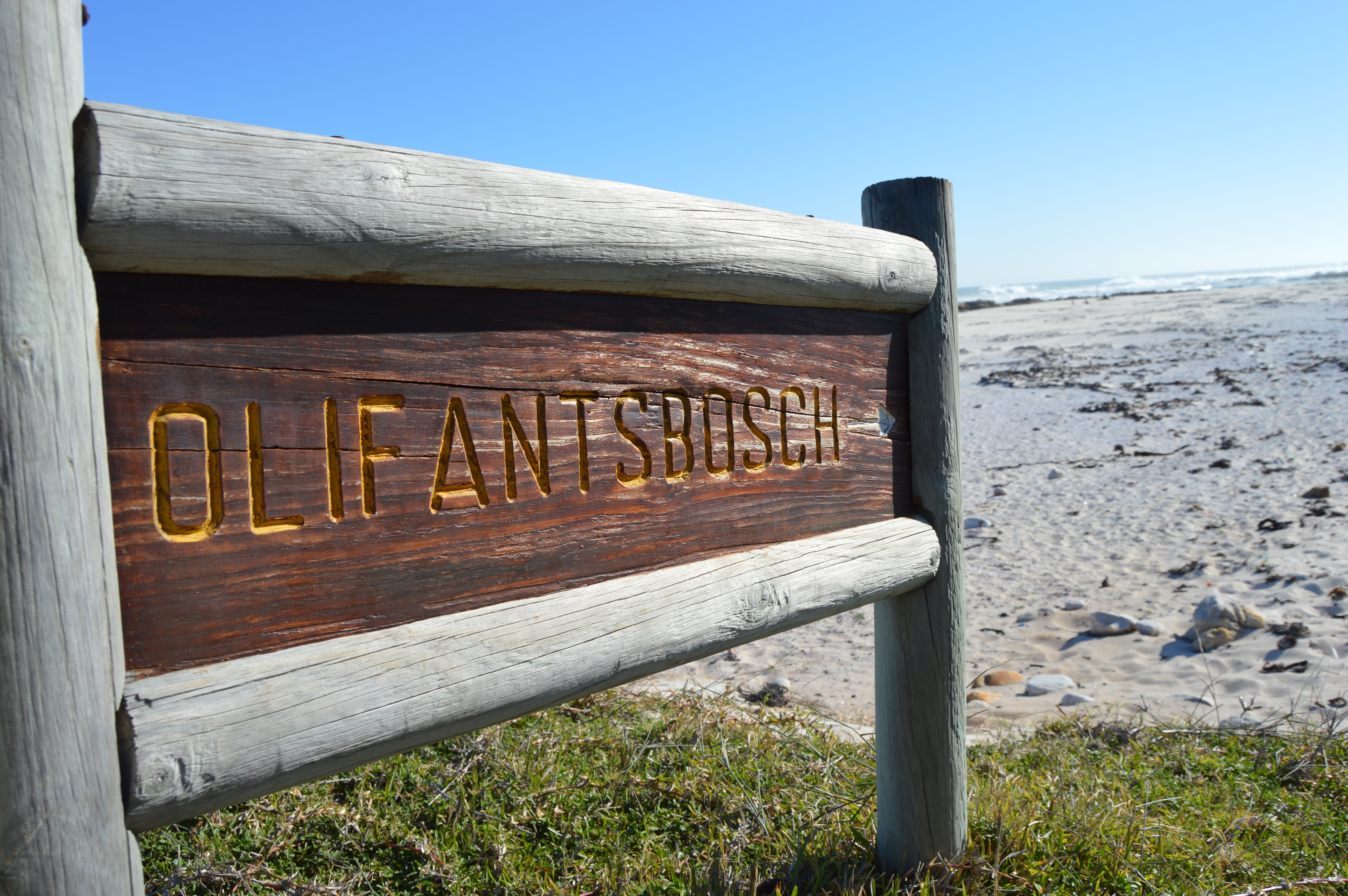
Olifantsbos: Explore the Shipwreck Hiking Trail (Cape Point)
Photo courtesy of Dr Tina Koziol Cape Point • Nature & History Explore the Shipwreck Hiking Trail at Olifantsbos (Cape Point) A short coastal hike…
Read Article
Hermanus Whale Festival: A First-Timer's Insider Guide (2025 Edition)
First-Timer's Guide Hermanus Whale Festival Everything you need to know for your first visit — the best lookout points, insider tips, festival highlights, where to…
Read Article
Cape Town Adventures 2025: Soar, Slide, and Dive into Africa's Wild Side
Photo: Wikimedia Commons ( CC BY‑SA 2.0 ) Cape Town has always been the adventure capital of Africa – but in 2025 , the Mother…
Read Article