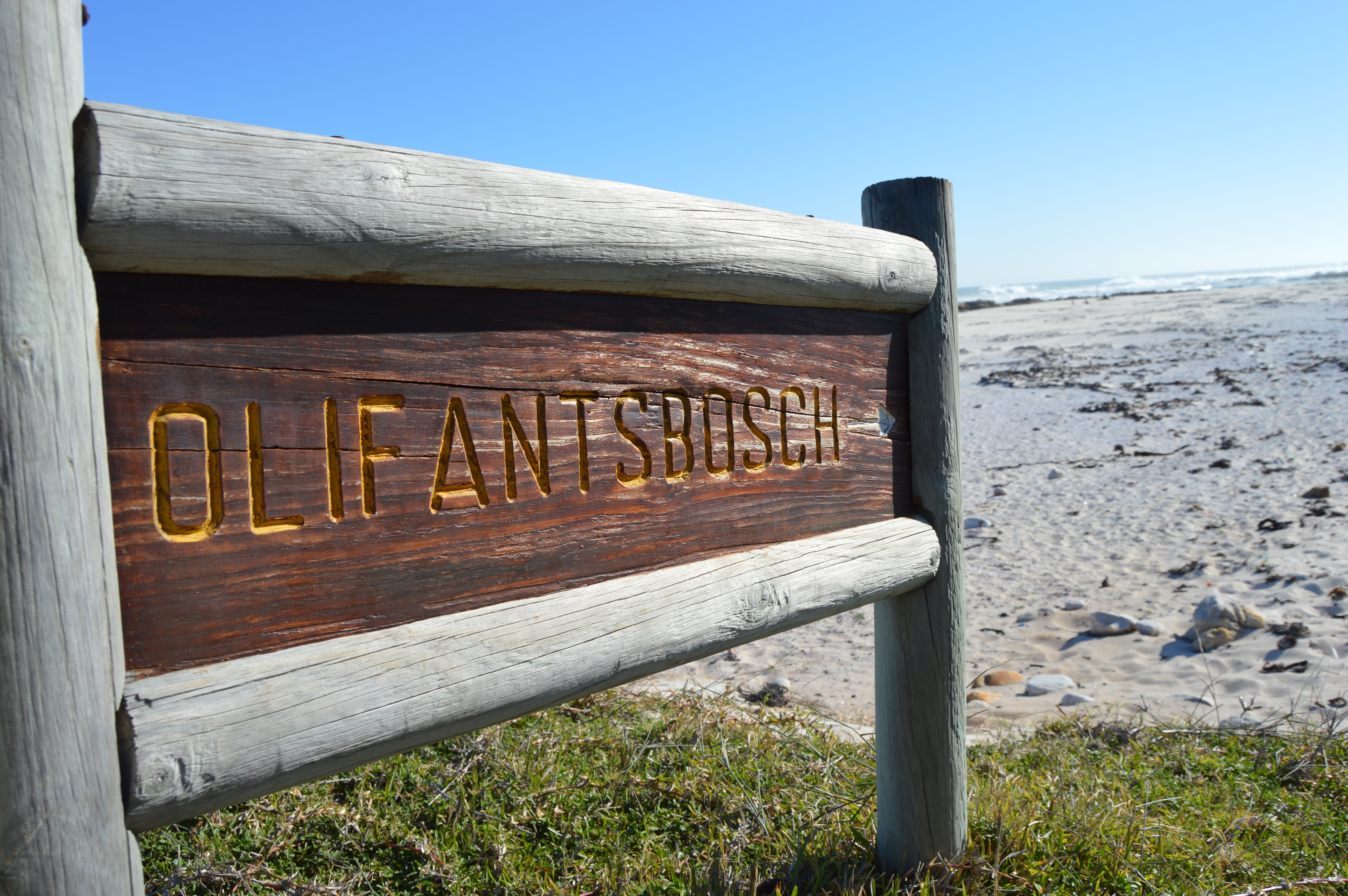
Olifantsbos: Explore the Shipwreck Hiking Trail (Cape Point)
November 10, 2025
Cape Point • Nature & History
Explore the Shipwreck Hiking Trail at Olifantsbos (Cape Point)
A short coastal hike with big scenery and bigger stories: WWII shipwrecks, windswept fynbos, ostriches on the beach and the “Cape of Storms” at its wildest. Here’s how long it takes, who it’s for, what it costs, when to go, route options, map, safety and smart packing tips.
Short version: From the Olifantsbos parking, follow yellow markers to the coast and walk a sandy shoreline to the famous SS Thomas T. Tucker (wrecked 1942). Keep going to the SS Nolloth (1965) for the longer loop, then return on an inland ridge path. Expect 3–6 km and about 1.5–3 hours depending on the loop you choose. Entry is via the Cape of Good Hope (Cape Point) gate; conservation fees apply (cash-free). [2] [1]
Distance: 3–6 km (loop) Time: 1.5–3 hrs Grade: Easy–Moderate (sand & boardwalk) Wildlife: ostrich, bontebok, zebra Fees: cash-free at gate
Who it’s for
This is the most accessible historic walk in the Cape Point reserve: wide paths, boardwalk sections, long sand stretches, and very gentle gradients. It’s ideal for visitors who want big Atlantic drama without a full-day mountain slog; families with patient walkers (not pram-friendly on sand); photo-hunters; maritime history fans; and birders. Along the way you’ll often spot ostrich, bontebok, Cape mountain zebra and tortoises grazing the fynbos behind the beach. [4]
How long & how hard is it?
There are two classic choices from Olifantsbos:
- Short loop (~3 km, ±1.5 hrs): Parking → coast → Thomas T. Tucker → loop back on inland path. Rated easy; minimal elevation. Multiple guides list ±3 km and ~90 minutes. [2]
- Longer “Shipwreck Circuit” (~5–6 km, 2–3 hrs): Continue past the Tucker to the Nolloth, then return on the inland ridge. Some route logs show 5–8 km variants depending on exactly where you turn inland. [5]
AllTrails users also record a popular loop of about 5.3 km (3.3 mi) with light up-and-down and ±115 m total elevation—still squarely an easy-to-moderate outing for most walkers. [3]
When to go (season, wind & tides)
Season: Cape spring and autumn (Sep–Nov, Mar–May) are the sweet spots: clear mornings, crisp air, and lower fire-danger winds. Summer’s fine too—just start early to avoid midday sun and the Cape Doctor’s south-easterlies. Winter can be magical on calm, sunny days but brings fronts and bigger surf.
Wind & exposure: The trail is very exposed. On strong SE or SW days, expect sandblasting on the beach and buffeting on the ridge. The area is even a noted surf zone—“Cape of Storms” reputation well deserved—so check a reliable forecast and go early. [4]
Tide awareness: Most of the route is walkable on normal tides, but a higher tide and onshore winds can squeeze you against rocky points—particularly beyond the Tucker towards Nolloth. If in doubt, do the short loop or take the inland return early.
Costs, gate info & Wild Card
Olifantsbos lies inside the Cape of Good Hope (Cape Point) section of Table Mountain National Park. You’ll pay a daily conservation fee at the main gate (cash-free: card only). South Africans: R110 adults / R55 children. SADC: R225 / R115. International: R515 / R250. Valid 1 Nov 2025–31 Oct 2026 (subject to change). [1]
Good to know: Cape Point and Boulders gates are cash-free; bring a card. The official page also notes ID checks for local rates and SADC passports for regional rates. [1]
If you’re visiting multiple SANParks in a year, consider a Wild Card (annual access to partner parks—fees waived for day entry on a valid card). [1]
Route description (short & long loops)
Start: Olifantsbos parking
From the end of the Olifantsbos access road, pick up the yellow markers that cut through coastal grass and fynbos down to the beach. Within minutes you’re on sand with the Atlantic on your right and low dunes on your left. The path is intuitive—much of it is simply the beach itself. [2]
Short loop to the Thomas T. Tucker (~3 km)
Head south along the beach to a scatter of twisted steel and plates—the remains of the SS Thomas T. Tucker. The boiler sits higher on the sand with other sections closer to the surf line. Take your time to explore; then loop back on the inland ridge path (signed), which returns you to the parking with big views back over the bay. [2]
Longer loop to the Nolloth (~5–6 km)
Continue beyond the Tucker around the next rocky bend to the SS Nolloth, a 347-ton Dutch coaster wrecked in 1965 after striking Albatross Rock—large portions are still visible from the beach. From here, turn inland shortly past the wreck and follow the ridge path back to Olifantsbos, or carry on further to link trails towards Sirkelsvlei if you’re building a bigger day (fit, prepared hikers only). [5]
Interactive map overview
Markers show the trailhead and coastline highlights; wreck positions are approximate and may shift with sand movement.
What to pack
- Water: 1–1.5 L per person (more in summer). There’s no potable water on the route.
- Sun & wind: Hat, sunglasses, SPF 30+, a light windbreaker—even on hot days.
- Footwear: Grippy trail shoes or light boots (sand + occasional slippery rock).
- Navigation: The route is obvious, but carry a charged phone/GPS; pick up a printed map at Buffelsfontein if you like paper. [2]
- Extras: Snacks, small first-aid kit, camera/binoculars, and a bag to pack out all litter.
Safety: surf, wind, wildlife & crime
Ocean & surf: Rogue waves and slippery rocks are the real hazards—keep a safe distance from surging water on windy days (especially near rocky points). Surfers know Olifantsbos for powerful Atlantic swells; if the sea looks angry, it is. [4]
Wind & exposure: There’s very little shade. Start early in summer; if a gale is forecast, choose a more sheltered TMNP walk.
Wildlife: Give ostriches a very wide berth; do not approach for photos. Never feed baboons (rare on this western side but possible). Expect benign encounters with bontebok/zebra—always at a distance. [4]
General crime: Cape Point trails see far fewer incidents than the city-flank mountains, but apply common sense: hike in pairs/groups, tell someone your plan, and keep valuables concealed. Some guides promote an optional WhatsApp “safety tracking” check-in service on shipwreck trails—use it if available. [2]
Wreck history: Thomas T. Tucker & Nolloth
SS Thomas T. Tucker (1942): A US Liberty ship on her maiden voyage to Suez ran aground off Olifantsbos in heavy fog on 27 Nov 1942, reportedly after compass error and coastal navigation to avoid U-boats. The wreck lies in multiple sections along the beach and rocks; the boiler is often visible above the sand. Fortunately, there was no loss of life. [6]
SS Nolloth (1965): A Dutch coaster that struck Albatross Rock and beached near Olifantsbos; parts of the hull remain conspicuous and are a natural rest spot before you turn inland. [5]
What you won’t find: Despite the rich history, on-site interpretive boards are sparse; most context lives online, so consider pre-reading a short wreck history before you go. [2]
Summary table: route stats
| Route option | Distance | Elevation gain | Typical time | Difficulty | Highlights |
|---|---|---|---|---|---|
| Short loop (Tucker) | ~3 km | <150 m | ~1.5 hrs | Easy | Quick access to the Tucker, wide sands, inland ridge views. [2] |
| Shipwreck Circuit (Tucker → Nolloth) | ~5–6 km (variants up to ~7–8 km) | ~100–150 m | 2–3 hrs | Easy–Moderate (sand walking) | Two wrecks, WW2 relics, fynbos & seabirds. [5] |
| AllTrails loop (popular GPX) | ~5.3 km (3.3 mi) | ~115 m (374 ft) | ~1–1.5 hrs (fast parties) | Easy–Moderate | GPS-friendly, well-trod variant. [3] |
Sources
- SANParks — Cape of Good Hope (Cape Point) visitor info, fees & cash-free gate.
- Inside Guide — Shipwreck Trails at Cape Point.
- AllTrails — Olifantsbos Shipwreck Trail (Thomas T. Tucker).
- SA-Venues / Cape Point — Route overview & wildlife to expect.
- Cape Point blog/notes — Nolloth details & shipwreck trail guidance.
- Wikipedia — SS Thomas T. Tucker.
- Ostrich Trails — Field-guide style route description.
Always check the latest gate hours, conservation fees and weather before you go. Respect the ocean and stay clear of surging waves on rocky points.
You May Also Like

Explore this hidden gem: Cecilia Forest hike
Southern Afrotemperate forest in Cecilia Forest, Cape Town. Photo by Abu Shawka, via Wikimedia Commons , licensed under CC BY-SA 3.0 . South Africa •…
Read Article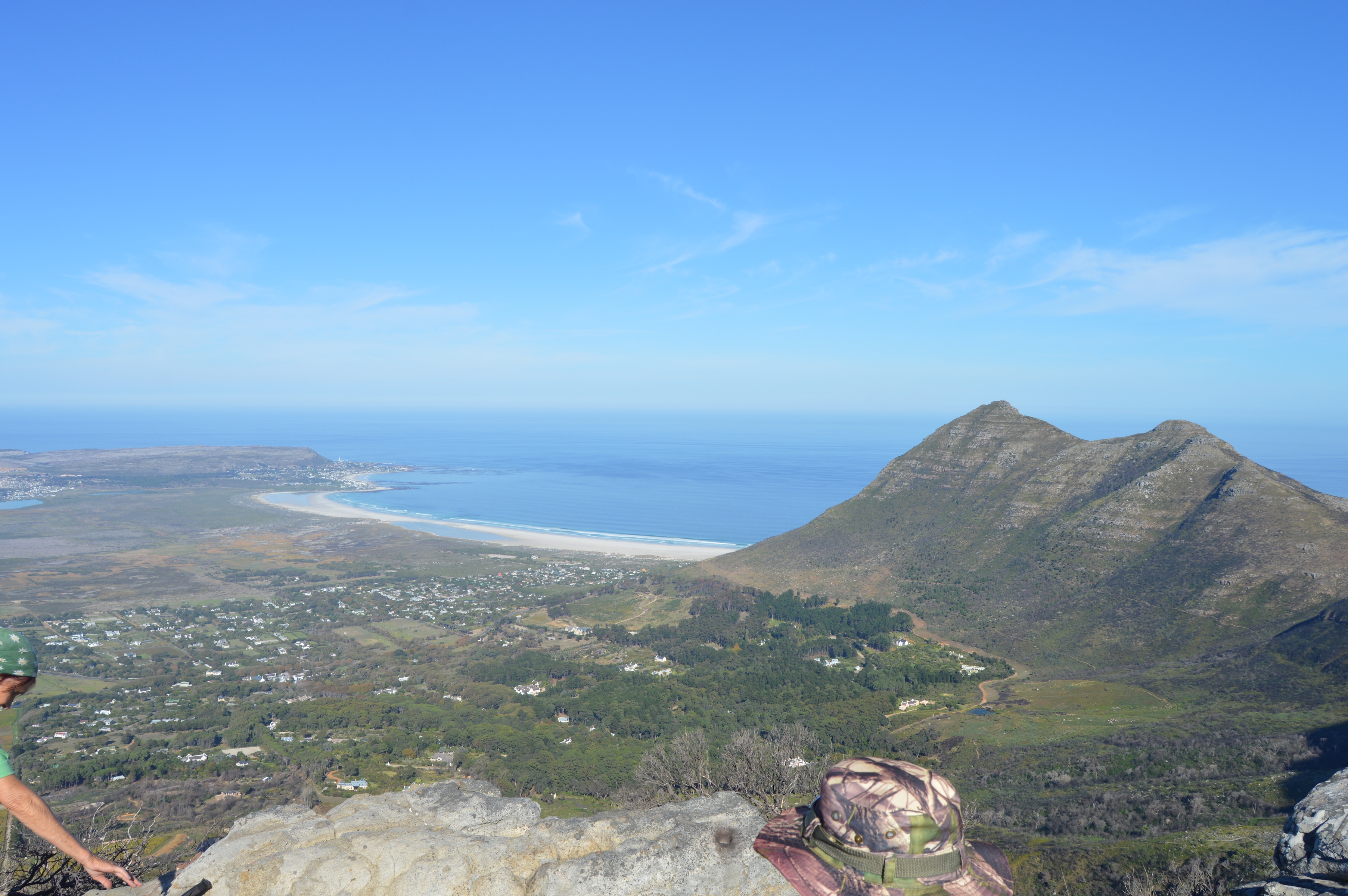
Silvermine Panorama Circuit: The Most Underrated Hike Above Cape Town
Photo: Dr Tina Koziol Powered by Wikiloc Cape Town • Table Mountain National Park • Hiking Guide Silvermine Panorama Circuit: The Most Underrated Hike Above…
Read Article
Look through India Venster while hiking this spectacular route up Table Mountain
Photo courtesy of Moheen Reeyad, Wikimedia Commons, licensed under CC BY-SA 4.0 Powered by Wikiloc Meaning of the Name 'India Venster' Why the India Venster…
Read Article
Exploring Llandudno Beach and the Shipwreck Trail
Photo courtesy of Wikimedia Commons, licensed under CC BY-SA 4.0 Powered by Wikiloc Table of Contents Introduction 1. Llandudno at a Glance 2. The Shipwreck…
Read Article
Pipe Track Walk on Table Mountain: Easy start of the day
Table of Contents: History: Origin of the Pipe Track Why the Pipe Track is Popular Route Description: Terrain, Views, and Flora Trail Navigation and Conditions…
Read Article